Showing posts with label Boyle Heights. Show all posts

Saturday, January 14, 2023

Redlined L.A. & the Chinese American Doctor - Bunker Hill, Chinatown & Beyond in the 20th Century

This post grew out of a curiosity about the important man who introduced me into the world:  my mother's obstetrician.  Dr. Samuel Yen Eng was one of two L.A. Chinatown doctors in the 1950s and 1960s who practiced western medicine (as I had heard growing up).

Dr. Samuel Yen Eng, M.D. (1905-1972)

Dr. Eng was born in San Francisco.  In 1928, he completed the four years of study at the College of Medical Evangelists, and he was on his way to being a physician in his early twenties!  The names of his graduating class were listed in the San Bernardino Sun newspaper, and he appeared to be the only Chinese student.  The college later became Loma Linda University's School of Medicine.

Los Angeles Redlining Practices of 1939

Unbeknownst to him, throughout his life he traversed around a secret color-coded housing and mortgage lending landscape established by the government-sponsored Home Owners' Loan Corporation.  By tracking his addresses through the federal censuses, it is easy to determine that he lived and worked in or near redlined areas shown on a 1939 residential security map of urban Los Angeles - that is, pockets of the county shaded Red - deemed "hazardous" and least desirable in livability.  The criteria was based on the race of residents, and areas populated by people of color.  In comparison, the Yellow-shaded areas were defined as area "in decline" and not as bad as the Red areas. For a concise explanation with a high-rez map available, visit here.

Published by the Home Owners' Loan Corporation

Boyle Heights

After graduating from medical school, he and his wife Helen resided in Boyle Heights likely because Dr. Eng was working nearby at White Memorial Hospital that was founded by his alma mater.  A 1930 occupational directory listed him at 2032 E. First Street.  Another address pinned them at Michigan Avenue and Echandia Street as renters with another couple who were both also in the medical field.  Their nearby, non-Asian neighbors were medical professionals, too. (Source:  1930 Federal Census).  By 1939, the redlining policy relegated all of Boyle Heights to Red, the worse grade on the residential security scale.

City Market and the East Adams Neighborhood

Chinese Americans settled near the 1909 City Market, and a Chinese American enclave extended south about 1920 along East Adams Boulevard near San Pedro Street.  The population shift stemmed, too, from the clearance of Old Chinatown beginning in 1933.

(My parents' rental at 812 E. 21st Street in East Adams was where I was brought home as a newborn.  It was from Jenny Cho's 2005 book Revisiting East Adams that led me to realization that I was a part of that community.)

All of the East Adams area was graded Red.

The 1938 city directory listed Dr. Eng's residence at 3725 Dalton Avenue, near Exposition Boulevard & Western.  The area was graded Red.  The listing also indicated his medical office was at 1057 South San Pedro Street -  the epicenter of Chinese businesses located near the City Market.  Various occupational directories and city directories between 1933 through 1942 placed his long-established practice here.

Compton/Willowbrook

He was a homeowner by 1940 at 1919 East 122nd Street in Compton (Source:  1940 Federal Census).  It must have fit his growing family of four children.  The property hadn't been redlined because it was defined as "industrial."

In 1948 a Supreme Court ruling made illegal the practice of placing restrictive racial housing covenants in property deeds, and this practice was a parallel discriminatory tactic against fair housing.  The ruling was a starting point though it would take many more decades to eliminate redlining and these covenants.

Meanwhile, the doctor, who was also a returning veteran, moved west to 2033 El Segundo Boulevard, Willowbrook (Source:  1950 Federal Census).  This site was considered "agricultural" in the 1939 redlining map.  Today the address no longer exists, and a tract development took its place.  Noteworthy was the proximity of his house to the 1926 Western Avenue Golf Course - stray golf balls could have landed in his yard.  Did the doctor play golf?

The "New Chinatown" Doctors

During the war period what doctors cared for the Chinese community?  Families & babies managed to grow despite the Chinese exclusion immigration policy. 

It is unclear of the exact year in which Dr. Eng moved his practice to New Chinatown.  The vicinity of North Broadway & Macy Street (Macy is now Cesar E. Chavez Avenue) became New Chinatown by 1950.  Prominent Chinatown doctor, Julius F. Sue, set up his practice here in the 1950s.

Dr. Eng was listed in the May, 1956 city directory at 431 Bernard Street.  (In the 1939 redlining map Bernard Street provides a boundary for a Red zone - no surprise here.)  He remained here until his death in 1972.

His office operated out of an 1892 Victorian house.  Today the house still stands and is a few doors down from the headquarters of the Chinese Historical Society of Southern California.  I vaguely remember being in the waiting room.  I also remember Dr. Eng making a house call when my two brothers and I were sick.

Dr. Eng attended to my birth as well as my two brothers at the German Hospital - in the Boyle Heights neighborhood he was long familiar with.

The World War II Draft and the American Legion

Dr. Sue was just graduating from high school in 1934 when Dr. Eng was a young doctor, and they both served in the military throughout World War II.  According to Duty & Honor:  a Tribute to Chinese American World War II Veterans of Southern California (edited by Marjorie Lee), about 13,499 Chinese living in the U.S. had served in the war, and over 500 were from southern California.  Four individuals were medical doctors, and Dr. Eng had by far more experience than the other three degreed soldiers.  Dr. Sue is remembered for many accomplishments, such as founding the Chinese American Medical Association of Southern California.  

Dr. Eng turned 35 years old shortly before the draft, and he held the rank of Major in the Army Air Corps.

Courtesy of Duty & Honor, p. 112
(Chinese Historical Society of Southern California, 1998)

In 1946 upon his return from war the doctor organized and was the first commander of the American Legion's newly established Chinese American post.  Interestingly, he established their headquarters along the same block where his medical practice was before the war.

Courtesy Duty & Honor, p. 29

Investing in Bunker Hill and the Alta Vista Apartments

About the time the restrictive racial covenants were outlawed in the U.S. in 1948, locally the city of Los Angeles announced the wholesale clearance and redevelopment of blighted Bunker Hill in downtown.  Though redlined as a Red zone in 1939, at some point in time Dr. Eng and other investors purchased the Alta Vista Apartments at 255 South Bunker Hill Avenue.

Courtesy of the California State Library

The 1903 Alta Vista was worn out by the late 1950s, and it was a place that inspired novelist John Fante from his transient, brief stays there between 1933 and 1934.  The building was a film location for the 1951 film noir by Columbia, called "M."

The income property became an ill-fated investment.  A lawsuit by Dr. Eng, et al, against the city's Board of Building & Safety Commissioners was decided in 1960, after the building was earmarked for demolition in 1959.  A case summary can be read here.

Only the fictionalized Alta Vista endures.  It is doubtful that the doctor was aware of the building's significant role in Fante's story, Ask the Dust.  The novel, little-known when published in 1939, garnered widespread fandom in the years after the doctor was no longer living.

Noteworthy: the legal counsel for his case was another war veteran Hiram W. Kwan from the Chinatown law firm of Kwan, Quon, Cohen and Lum.  Kwan died in December, 2021 after a long life of community and patriotic service.  He was born in Cuba, and upon residing in his new city of Los Angeles, he lived in the East Adams district at 757 E. 20th Street (Source:  1940 Federal Census).

Final Resting Place

As today I live next to the largest cemetery in the world, it is not really surprising to know that Dr. Eng is nearby at Rose Hills Memorial Park.  It is prime real estate.

Photo courtesy of Chris Sandoval, Find A Grave


Tuesday, February 2, 2021

The German Hospital in Boyle Heights Has Been Demolished

Part I (1:35)

The former German Hospital erected in Boyle Heights was profiled last October.  It came under active demolition the morning of December 16th, and this series of videos document the last moments of the original 1904 building.

An eyewitness, Ms. M. Rodriguez, texted me as it was happening.  She explained that demo work began on December 1st along the small cottages to the south of the original building as well as other structures to the west.  Then all activity stopped.  She learned from a neighbor that there may have been a question about the historic status of the main building.  Was that all cleared up and the bulldozers were then resumed?

Photojournalist Gary Leonard arrived on the scene within 20 minutes of Ms. Rodriguez notifying me.  He got there at the exact time to capture the destruction in the final five minutes of the standing hospital building.


Part II (:23)

Part III (1:35)

Finale (1:15)


Monday, November 16, 2020

The German Hospital in Boyle Heights, Los Angeles, Cal.

[Update February 2021:  The hospital has been demolished]

The vacant former hospital on Soto Street near Fourth caught fire - again - the night of October 11th.  The fire crew took just over one hour to contain the outbreak, but it seemed routine because it was the fourth fire in the last two years.

I was alerted by email from my brother informing me that the old Lincoln Hospital was damaged.  It was where my brothers and I were born.

(Courtesy ONSCENE.TV)

Upon hearing about my personal connection to the fire, curiosity prompted photojournalist Gary Leonard to visit in the following days.  Gary sent me a photo of Eileen Marquez, a passerby appropriately wearing a white top emblazoned with the words "Baby Girl."  He humorously suggested that it was a nod to me - one of the many baby girls to have entered the world at Lincoln Hospital.

Eileen had told Gary that she attended Garfield High and was born at County Hospital.  She was delighted to be photographed because her best friend was born at this hospital.

Eileen Marquez
(Photo courtesy of Gary Leonard)

A Promising Future and a Promise Lost

In 1901 the Germans in Los Angeles celebrated the 30th anniversary of the German Empire, just as they had done in the city since 1871.  This particular gathering was dedicated to raising funds to construct a German hospital.  But their pocketbooks may not have been as full as their pride because it took an Irishman to help things along.

A fellow named Max Werner died of appendicitis in 1897 and in his will everything was left to his mother Louise back in Germany.  Terms stipulated upon her death the estate would go to a New York City charity.  Henry Workman Keller, son of pioneer merchant and rancher Mathew Keller, was Werner's executor.  The will was contested, and the New York charity received only a fraction of the estate in 1898.  When Louise died in 1903, the Los Angeles Herald reported that there were funds held in a bank earmarked for the German hospital. 

Community leaders led by physician Joseph Kurtz swiftly set up a corporation called Deutscher Hospital Verein, or German Hospital Association.   A year later, the groundbreaking was held in April, 1904.  The Herald reported a two-story [sic] brick hospital building would extend from 435 to 451 South Soto Street.  German national John Paul Krempel and Walter Erkes, an American, were the architects.  

A cornerstone dedication ceremony was held the following month, and by October the new hospital was open for business to accommodate 24 patients.

German Hospital cornerstone
(Photo courtesy of Gary Leonard)

Shown is the original building.  Building improvements were done in 1922, 1923, 1927, 1964 and 1985.  The 1927 expansion was the largest by adding over 19,000 square feet

Keller, a businessman and property investor, built a handsome two-story brick home in 1907 less than a mile away at Fourth and Boyle Streets.  The showcase house had 18 rooms of which five of them were bathrooms.

Noteworthy Patients

In 1915 Lillie Mulholland, age 47, expired at the hospital.  She was the wife of city engineer William Mulholland.

The Association made a decision to adopt a new name, Lincoln Hospital, in 1918.  

Another patient in 1920 was Emil Harris, the city's first Jewish police chief.  His name is well-associated with the history of the 1871 Chinese Massacre when he was an officer on duty as rioting broke out.  

The hospital architect Paul Krempel continued with an active career in his adopted city.  He resided on Rodeo Drive in Beverly Hills.  Yet when he suffered a heart attack, he was transported clear across town to be treated at Lincoln Hospital where he expired in September, 1933.

It is unclear to me when the hospital changed from a non-profit to an investor-owned hospital.  The hospital's final years operated as Promise Hospital of East Los Angeles.  Since the closing, a 2017 plan to build a charter elementary school fizzled.
 
Photo courtesy of Gary Leonard

Photo courtesy of Gary Leonard

My brothers, my mother and I pose for Gary
   

Photo courtesy of Gary Leonard

Photo courtesy of Gary Leonard

Photo courtesy of Gary Leonard

Photo courtesy of Gary Leonard

Photo courtesy of Gary Leonard

Photo by blogger


Photo by blogger  

Photo by Gary Leonard

A view of the former Promise Hospital and its neighbor, Northgate Market.  Photo by blogger


Two fire department officials stopped by on the Sunday morning

The rear of the original hospital building.  Photo courtesy of Gary Leonard


Photo courtesy of Gary Leonard

Los Angeles Herald, October 3, 1904 
Courtesy of California Digital Newspaper Collection, Center for Bibliographic Studies and Research, UC Riverside, <http://cdnc.ucr.edu> 

Original brick from one of the building additions.  Photo by blogger

 
During the visit to the former hospital grounds, squatters were entering and leaving the building without regard to the fencing and red tagging.  Strewn on the pavement were personal articles belonging to adults and children.
 
Photo by Gary Leonard


Photo by Gary Leonard

 
Photo by Gary Leonard

Photo by blogger

Photo by blogger

Photo by blogger

Photo by Gary Leonard


Gary Leonard

Monday, October 23, 2017

Origins of "Soto Street" in Boyle Heights


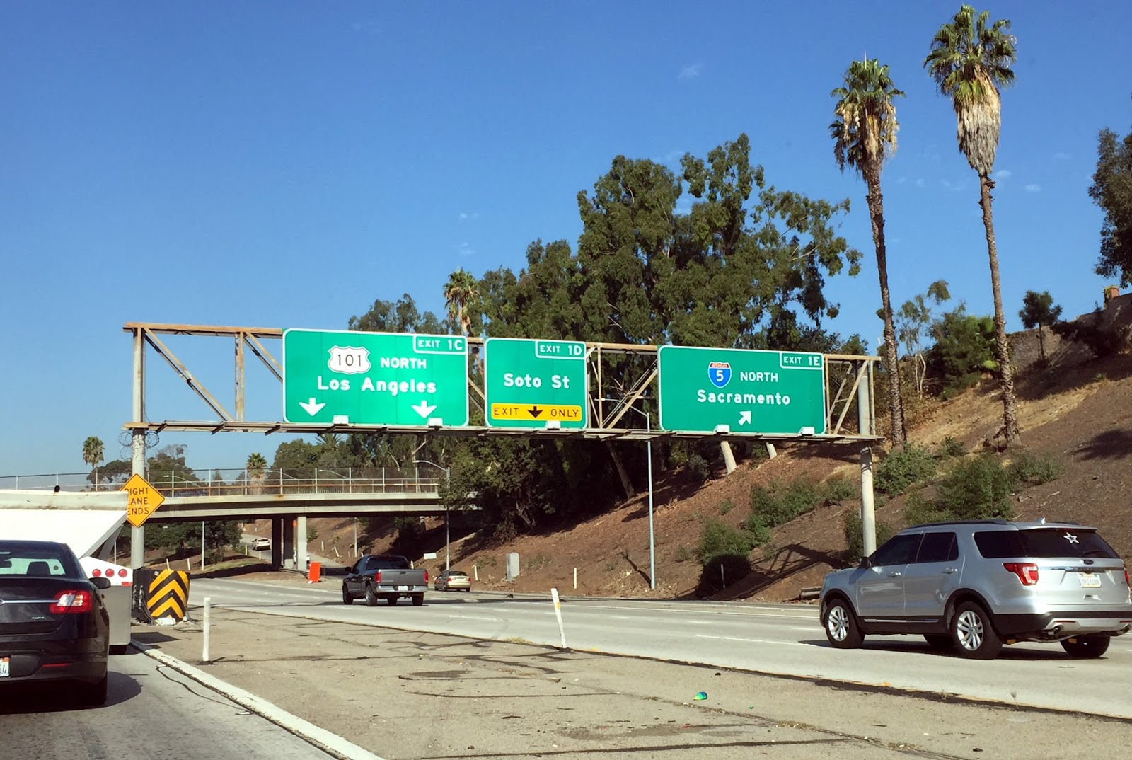
A northbound trek onto Soto Street makes for a tolerable surface street drive from East L.A. out to Silverlake during the rush hour.  Always assumed that this street was named for the famed Spanish explorer, Hernando de Soto.  But this blog post is leaning towards the idea that the street name was meant for Pablo Vicente de Solá.  Update 9/16/2023:  An astute street names researcher, Mark Tapio Kines clarified the origins on his website L.A. Street Names.  But I still think that the naming pattern for a select group of Mexican California's governors, explained below, was somehow part of the transformation of the street's name.

KCET's Nathan Masters explored some early L.A. street-naming by 19th century city dreamers.  Five streets stuck and have ever since immortalized several provincial governors of California under Mexican rule:  Manuel Micheltorena, Juan Bautista Alvarado, José Figueroa, José María de Echeandía, and Pío de Jesús Pico.  Masters surmised that along with the governors, the plan shown on an 1857 map included naming the east-west streets after the first seven U.S. presidents.  (Today only the first three presidential street names exist: Washington, Adams & Jefferson.)

The Austrian-born surveyor, George Hansen, was active in the early decades following the admission of California to the Union in 1850.  Hansen must have been highly respected - the newspaper reported at the Saturday, April 28th, 1883 Common Council meeting that Hansen tendered his resignation as city surveyor and city engineer. But a motion was made to not accept his resignation - then another member moved to second the motion.  "Erudite" was an adjective used to describe Hansen; he spoke German, French, Spanish and English.  In 1857 he also formed the Anaheim colony.

In addition to the above-mentioned 1857 map (kept at the Los Angeles City Archives), three other historical maps that Surveyor Hansen probably had a hand in creating show one or more of the north-south arteries named for the governors:  1) an 1860 (or actually circa 1870) City Map No. 56 - housed in the Seaver Center; 2) an 1868 Official Map No. 2 - housed in the Los Angeles City Archives; 3) an 1870 Map of the Reservoir Lands, signed by William Moore, Hansen's good friend - housed in the Seaver Center.

This blogger theorizes that a road where today's Soto Street runs was a part of the plan, but the spelling may have gotten mixed up, as did happen with the governors' names.  The 1860/1870 map no. 56 lists "Sota"; the 1870 map of the reservoir lands incorrectly lists "Micheltoreno".

A portion of the City Map No. 56
Courtesy of the Seaver Center for Western History Research

Instead of "Soto" perhaps George Hansen drew a road to cover the city turf laying east of the Los Angeles River meant for Governor Pablo Vicente de Solá.  This governor served from 1814-1822, making him the final governor of Alta California under the Spanish crown.  He was born in Spain, highly-educated with wealth & social position, and he never married. 

He oversaw California at a time when Spain's rule in Mexico was unstable, so a lack of financial support and importation of goods was trying for him as governor, as well as for the lives of those in the pueblos, missions and presidios.  de Solá also maintained diplomatic relations with the Russians at Fort Ross, and he was concerned about the threat of a Russian expansion.  An informative 1961 masters thesis by Alvin Harry Johnson on de Solá can be found at the USC Digital Library.

One can also easily see that the naming of the governors was done so in the order that they served.  While Hansen (if he was the architect of the naming) skipped a lot of governors, he might have begun with de Solá, onto Echeandía, then Figueroa, then Alvarado, finishing with the most recent governor, Micheltorena, as the naming farthest west within the city limits. 

The exception was Pico, the last governor of Mexican California, whose street was drawn positioned east to west, as if to delineate a finality and to start a new American presence to the areas below Pico.  In 1850, the original spread of Los Angeles (a little over 17,000 acres) was insufficient to city officials eager to expand, but those southern areas would be awarded or annexed in later years.

Below shows modern-day boundaries of the original pueblo:

Below is the same map with an overlaying using rudimentary strokes approximating the governor and presidential streets as they exist today:


Most of the streets are today major arteries.  Micheltorena is fairly lengthy but is primarily a residential street in Silverlake adjacent.  In Boyle Heights, Echandia Street is the shortest of this historic group, perhaps the spelling not matching the correct surname spelling led to bad karma...

Soto Street, representing Hernando de Soto, perhaps suited the minds of the early American city fathers - after all, many of then, George Hansen included, came by ship around South America, and de Soto's reputation in Peru may have captured their imaginations. Update:  9/16/2023:  In conclusion, the street name was probably derived from a Soto family who owned land in the area as explained on the finely researched L.A. Street Names website, however I believe the naming of past Mexican California governors might explain about an earlier attribution to Governor Pablo Vicente de Solá.