Tuesday, August 31, 2010

Puente Hills: Some History

(Click on image to zoom in)


We caught a movie at the mall theater-plex over the weekend.  Being there prompted the questions:  what is the history of the mall and what is the meaning behind the place name "Puente Hills?"

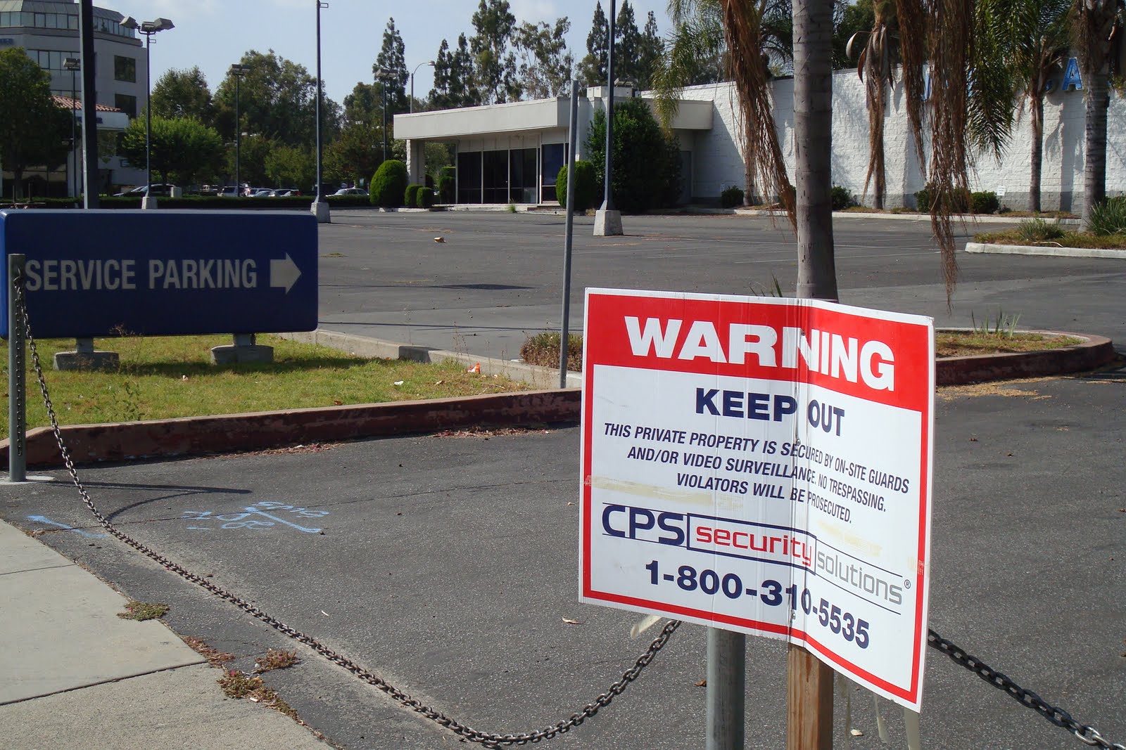
Puente Hills Mall opened in 1974 with these statistics:  stretching throughout 94 acres, it was built at a cost of $40 million in the City of Industry, anchored by four major department stores.  It would be the first of three malls to be completed in the San Gabriel Valley that would be "air-conditioned and enclosed," taxing the viability of the older, open-air Eastland Shopping Center in Covina.  The promises of an indoor climate in the Puente Hills Mall raised concerns as the nation was undergoing an oil embargo crisis.

Two other shopping malls to follow were Fashion Park in Arcadia, and Fashion Plaza in West Covina.  These developments surely foiled the work of the Puente Hills Community Coalition that had, as late as 1972, worked to curtail home construction in places like Diamond Bar, Rowland Heights, the Workman Mill area, and La Habra Heights.  Even before the Puente Hills Mall was completed, the developer, Western Harness Racing Inc., unveiled another plan to build Puente Hills East, a automotive shopping center, home furnishings center as well as offices, to be completed about 1979.

The mall gained a bit of notoriety when its south parking lot was featured in the 1985 film, "Back to the Future."  (Update from October, 2015 - see end of post for a mall promotion of the movie's 30th anniversary)

The Puente Hills extend from the western face (roughly at the location of Rio Hondo College) to Rowland Heights on the east, and the Pomona Freeway providing a general northern boundary, and the mountains have the following at its base:  Whittier, City of Industry, Hacienda Heights, La Habra, Rowland Heights, and Brea.  The hills have provided a century of petroleum sustenance, too.

(Courtesy of the Library of Congress American Memory Map Collection.)

The name "Puente Hills" is derived from the region that provided a "bridge" to dry land as the Spanish expedition led by Don Gaspar de Portola crossed a San Jose creek in 1769.  Rancho de la Puenta encompassed nearly 49,000 acres of former mission land.  The rancho was eventually granted by the Mexican government to "foreigners", the first overland American settlers, John Rowland and William Workman, about 1845.  By the end of the U.S. war with Mexico, the spelling, Puenta had changed in land claim records to Puente.

Neighboring ranchos of the 1840s Mexican California included Rancho de la Luis Arinas in the north, next to Rio San Gabriel, and Rancho El Susa, also owned by Arinas, which later became Azusa when Englishman Henry Dalton bought both properties.  Another neighbor was Ricardo Vejar's Rancho de San Jose.  Vejar also eventually purchased Rancho Los Nogales from the widow of Jose de la Luz Linares.

October 17, 2015:  While waiting for a 10:40 p.m. screening of Pan, a stroll through the mall brought an encounter with a Delorean on display, apparently to celebrate the Puente Hills Mall parking lot as one of the film locations for the original Back To The Future.


Update 7.21.2023:

In response to a couple of recent comments, here are photos I took way back in March of 2022.  I went to Macy's and came upon their storewide closing sale.  Sad to see them go even though I rarely went there in recent years...


Monday, August 30, 2010

Vacant Car Lots

Shuttered automobile dealerships are commonplace.  Here is a sampling along my routes:

On Las Tunas Drive, near the borders of San Gabriel and Rosemead, is an example of the state of the new century.
(Click on image to zoom in)
In the city of Whittier, on the stretch of Whittier Boulevard between the two shopping centers, the Quad and Whittwood, there are indications of the city's four out of nine dealerships that have closed, including the Cadillac lot seen above.  The city is changing the zoning to allow non-automotive-specific businesses take over these parcels.
(Click on image to zoom in)
Board Ford once operated at Whittier and La Serna, with homes of Friendly Hills just behind it.
(Click on images to zoom in)
The building at 15311 Whittier Boulevard was built in 1970.
Board Ford now has security.

Friday, August 27, 2010

A Dining Spot in Alhambra, Cal.

Henry's was located not far from Garfield Avenue and Valley Boulevard.  Its family chain of restaurants included Henry's of Glendale, Henry's Famous Rite Spot in Pasadena, and Carpenter's in Arcadia.

"All Featuring that Nationally Famous Chicken in the Rough."  (Somehow that does not sound very tasty.)

(Click on images to zoom in)
Where Henry's once stood, Gourmet Island opened for business at the beginning of 2010.  In May, restaurant critic Jonathan Gold pronounced these adjectives on the cuisine:  "sweetness" and "light."
Gourmet Island's interior is clean and fresh, and the food is very decent.

Thursday, August 26, 2010

Marcel and Jeanne's French Cafe in Montebello, Cal.

A 1957 advertisement.
(Click on image to zoom in)

The French Cafe was demolished in 2007.  The building sat at the corner of Whittier and 22nd Street for decades.  Its demise upset the Montebello community.  Some hoped that the old structure would find re-use as a community theater.  The following pictures were taken yesterday on my pilgrimage to the site.  (Click on image to zoom in)


Wednesday, August 25, 2010

Places to Stay n' Play in the San Gabriel Valley

Monterey Park, Cal.

A 1957 advertisement.
(Click on images to zoom in)

The motel in August, 2010.

The motel is flanked by requisite palm trees as seen from Garvey Avenue, a main road heading east and west before the Ramona Freeway (San Bernardino) came in by 1954.  The freeway ended in the east at Rosemead Boulevard, but an extension was completed around July, 1956.

Alhambra, Cal.

Further west these motels are also on Garvey Avenue, in Alhambra.
(I previously posted this location as Monterey Park in error.)
An earlier postcard look at the Midwick Motor Hotel, located at 2436 W. Garvey Avenue.
Present-day address is 1901 Garvey Avenue.

Montebello, Cal.

A motel right on the busy boulevard long before the Pomona Freeway came through.


The motel in August, 2010, its Californian moniker dropped.

Harriet Strong in Whittier, Cal.

Pampas grass grows on the side of my house in unincorporated Whittier.  It is a plant that has been the target of many eradication efforts, but here it is a symbol of a local historic figure.


About a mile from my house there existed Ranchito del Fuerte, Ranch of Strong.  The ranch had a Pio Pico provenance and the mighty touch of the woman Harriet Williams Russell Strong.

Governor Pio Pico (the last Mexican governor of Alta California) had a 'country' home within his land:  Rancho Paso de Bartolo.  (My house sits on the former rancho land, too.)  In 1867, he sold 220 acres to Harriet, her husband Charles, and her brother William Henry Russell.  Harriet's life revolved around raising four daughters, but that changed after Charles committed suicide in 1883.


Harriet in the driver seat
(Courtesy of the Seaver Center
for Western History Research)

She rose from a woman who had no business, financial or farming experience to a wiz ranch owner, inventor, land sub-divider, civic leader and an early inspiration for women's rights and self-independence.  She planted oranges; English walnuts on 50 acres on what amounted to be the country's largest; and pampas plumes.  When the fad for the plumes faded, she switched to the next latest commodity, pomegranates.

Workers with pampas grass (Courtesy of the Seaver Center)

Harriet overcame the water shortage by inventing and patenting dam and reservoir designs, ones that involved irrigation, catching debris, and storing water in steep valleys.  An early patent of hers was awarded in 1887, and she received her last patent for water storage in 1894.  Not only did she use her designs for herself and for profit-making, she also advocated and testified to the government of the need for federal efforts to enact flood control measures and store water for conservation and hydroelectricity.  Years following her death in 1926, two federal projects came to fruition that were based on Harriet's principles:  the Hoover Dam and the All-American Canal.

A segue from water wrangler to land subdivider occurred in 1900 when she created the Paso de Bartolo Water Company (a company with all-women stockholders) to service the land she purchased from Arcadia Bandini's Rancho Laguna holdings.  The tract Harriet subdivided was El Carmel, the first tract in today's City of Commerce.  Simons Brick Company's plant number 3 opened nearby in 1905, and Harriet's water serviced the brick compound also.

She had a full civic plate, too.  In addition to being the Whittier representative of the L.A. County Flood Control Association, she was the founding president of the Ebell Club; she was one of the first women to enter the membership of the Los Angeles Chamber of Commerce; she was a delegate in the 1920 Republican National Convention; she was a member of the National American Woman Suffrage Association, the Friday Morning Club, the Ruskin Art Club and the L.A. Symphony Association.

Not for shortage of civic organizations to participate, Harriet also founded a women's Republican group called the Hamilton Club; she founded the First Christian Science Church of Whittier; she spearheaded the efforts to save Pio Pico's house from destruction, and today the house is a part of the Pio Pico State Historic Park.

H.W.R. Strong, as she referred to herself in business records, is truly a little-known and under-appreciated role model.  Today, one of the few public markers to remember her is Strong Avenue, which runs east-west between Pioneer Boulevard and Workman Mill Road.  Her house is located further south below Beverly Boulevard on Orange Drive.


(Click on images to zoom in)


This is Strong Avenue towards Pioneer Boulevard.  The land here is very level and still.
The ranch-style houses are tidy.


Tuesday, August 24, 2010

MisiĆ³n Vieja Plaque

Junipero Serra led the founding of the Spanish Mission San Gabriel ArcĆ”ngel.  The San Gabriel location was the third choice.  The expedition actually arrived somewhere along the Santa Ana River in 1771, but soon moved to present day Montebello, close by the Rio Hondo.  The precarious location made it susceptible to floods and prompted the move closer to the foot of the San Gabriel Mountains in 1776.

A plaque to remember MisiĆ³n Vieja, the "old mission," sits on a landscaped corner receding from the busy San Gabriel Boulevard by Lincoln Avenue, at the base of the Montebello Hills.  There is only one spot on unpaved dirt at Lincoln Avenue in which to stop the car and get out to sight-see.


A shady corner, a manicured anomaly along a busy thoroughfare.  (Click on images to zoom in)
A bell of the Spanish El Camino Real, the King's Road.

Installed in 1921.
A contemplative spot on the side of the road.
MisiĆ³n Vieja was nestled close to the hills.  Today there is an oil pump within view.

Thursday, August 19, 2010

Big Santa Anita Canyon and Hollywood

Hikers who enjoy trails in Big Santa Anita Canyon above the town of Sierra Madre might be familiar with Hoegee's Trail Camp.

The campground is a reminder of the Hoegee Resort, started by Michigan-born Arie Hoegee in 1908.  He ran it along with his wife and four kids until 1920.  After several ownerships that followed, a fire destroyed the resort in 1953.

Hoegee's family manufactured tents.  His father, also named Arie, was born in the Netherlands and produced tents, awnings and canvas for beach-goers, campers, and wagon covers in Los Angeles through the late 1800s.

Arie (junior) had an older brother, William, who operated a large sporting goods store in downtown Los Angeles, on Main Street, the Wm. H. Hoegee Co.  In 1904, the store was reported to contain 90,000 square feet.  William was very active in community organizations, and he sponsored sports teams, including bowling and baseball.

William Hoegee lived in East Hollywood.  In 1904 he became president of the Hollywood Improvement Association.  The same year he became a trustee of the Los Feliz school district; he was one of the district members to choose the location of Hollywood High School in 1904; some time before 1907 he donated land at Vermont Avenue and Prospect Boulevard to build a community center and named it Hoegee Hall.

Most likely he participated with Hollywood boosters like Griffith J. Griffith (donor of Griffith Park) and Hobart Whitley ("Father of Hollywood") to campaign for a physical connection of the city of Los Angeles to East Hollywood, via the successful union in 1904 whereby Sunset Boulevard (in L.A.) joined Prospect Boulevard (the main portion which later was re-named Hollywood Boulevard).  This triumph was an economic boom to the city of Hollywood.

William Hoegee died in 1919, the same year as Griffith J. Griffith.  He left a considerable estate in East Hollywood, near Hillhurst Avenue and Los Feliz Boulevard.  One chunk of property was sold the following year to a Hollywood entertainer, Maurice Tourneur, who immediately commission the construction of a grand residence.  After a few years, the house changed hands to an actress, Madge Bellamy.  Since then, the Cedars, as the house became known, was reported to have been lived in by actress Norma Talmadge.  This factoid, true or false, has been perpetuated by real estate agents.  Talmadge Street is nearby, and it was named so as a tribute to the Talmadge sisters, Norma, Constance, and Natalie.

Today, the Hoegee name lives on, through the San Gabriel Mountain hiking trail, but also through several Southern California businesses that are in the sporting goods and awnings trade.  (Thanks to R. Kato for his research.)

Tuesday, August 17, 2010

Jean Louis Vignes, Catalina Island & Lincoln Heights

Vignes Street

Vignes Street is a familiar marker in downtown L.A., such as the sign along the Hollywood Freeway seen below. The street name is attributed to Jean Louis Vignes, who arrived in Los Angeles in 1831, having traveled to California from the Bordeaux region of France.

He bought a tract of land adjacent to the Los Angeles River (near the present location of Alameda Street and south of Aliso Street) and laid out El Aliso Vineyard, named for a huge, shady sycamore tree. Vignes, whose name means “vines” in French, imported fine grape vine cuttings from Bordeaux. He became the most important winemaker in the West, producing as many as forty thousand gallons a year and is today considered a pioneer of California wine-making.


Vignes at Santa Catalina Island

In 1840, Vignes and a man named Juan Ramirez petitioned the Mexican government to use Santa Catalina Island for Merino sheep raising. They argued that the sheep industry was all that was possible for the rugged island terrain.  They further persuaded that the island was absent of danger from "carnivorous animals."  Their petition may not have been granted, because Vignes was active in wine-making by that time.

Vignes in Lincoln Heights

Extended family members were encouraged to join Vignes in Los Angeles and participate in wine-making. One such person was Vital Ferdinand Vignes, a nephew. In the late 1880s, a Vignes orchard (possibly of Vital's or another relative) was established in Lincoln Heights, on an elevated piece of land above Prichard Street (now Lincoln Park Avenue.)

This area in 1873 was known as East Los Angeles, and the vast land holders included John S. Griffin (a physician of the army during the U.S. War with Mexico 1846-1848), John Downey (state governor during the Civil War and the city of Downey's namesake), and Griffin's nephew, Hancock Johnston.

Pictured below is today's Keiro Nursing Home, which resides on the hill top, a portion of the former Vignes orchards.  My dear mother-in-law and father-in-law, who both spent their last days at Keiro, would have appreciated the agricultural history of area.  When they were well they tended their own garden of citrus fruits and vegetables.


Keiro Nursing Home in Lincoln Heights.
(Click on images to zoom in)